Mountain Hiking in Uganda takes place in protected areas mostly with mountains. The country is known as the Pearl of Africa because of its never ending beauty located in East Africa. It is bordered by Tanzania, Democratic Republic of Congo, Kenya and the Republic of South Sudan. It is characterized by a savannah wood and grassland, montane forest, bamboo forest heath and moorland. These are natural habitats of wild animals, including mountain gorillas, zebras, chimpanzee, golden monkeys, antelopes like impala, oribi, Uganda kobs, Jackson hartebeests, elands have been dotted and distributed naturally in each eco system. Most of Uganda’s mountains species live in the forested areas like the mountain duikers, giant forest hogs, forest elephants among others. Mountain Hiking in Uganda is at Mountain Rwenzori, Mount Elgon, Mountain Sabyinyo and Muhabura in Mgahinga National Park.
Mount Elgon is placed inside Mount Elgon National Park. Elgon is an extinct volcano, tucked between borders with Kenya and Uganda. It has the world’s widest caldera and the largest foot base compared to any other volcanoes which are occupied by bantu, and the Kalenjins. Traditionally the mountain is referred to as Mount Masaba believed to be the origin of the Bamasaaba. The highest peak is Wagagai.-4321m above Mount Elgon National Park has a diversity of animal and bird species among which are elephants, hyenas, tinny antelopes, and over 300 bird types some of which include the Jacksons francolin, African blue fly catcher, Alphine chat, moustache green tinker bird to mention a few.
Elgon is believed to have been one higher than Mount Kilimanjaro. The highest mountain in Africa at the time it first erupted, but it still qualifies as the fourth highest mountain in the area. Mount Elgon National Park is 1145 square kilometres in size and is the oldest physical feature in East Africa. The simplest mountain to climb in Uganda is Mount Elgon National Park; it is, in fact, less crowded year-round and climbing does not take a lot of experience, only physical stamina. The numerous trails make it possible for visitors to reach their destination; The Sasa trail, which ascends from Budadiri town in Sironko town, is the quickest and only way to reach the summit in four days; the Sipi Falls trail, which begins at the Kapkwai exploration centre, is the longest but most adventurous way to reach the forest’s summit; it travels through the northwest part of the forest; and the Piswa route, which takes seven days along a gentle trail and starting at the village of Kapkwata, on the north side of the mountain it is known for excellent views of wild life and the Karamojong plains.
The early settlers of the area lived in thatched and semi-permanent homes around the mountain base; they are the only race in Uganda to practise cultural circumcision; Arabic coffee and barley are the main cash crops grown here; and activities like visiting the Sipi Falls and guided nature walks in Mount Elgon provide opportunities to view beautiful waterfalls and caves that were created during the time of volcanic activity. The peak is 235 kilometres from Kampala and may be reached via northern Uganda’s Kidepo Valley National Park.
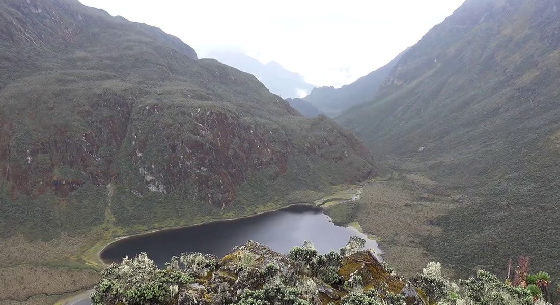
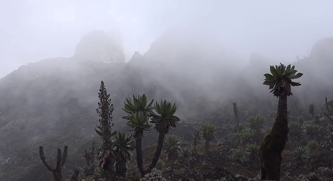
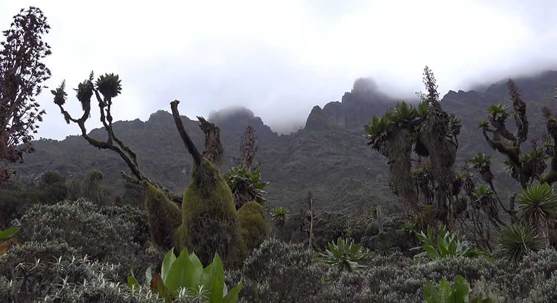
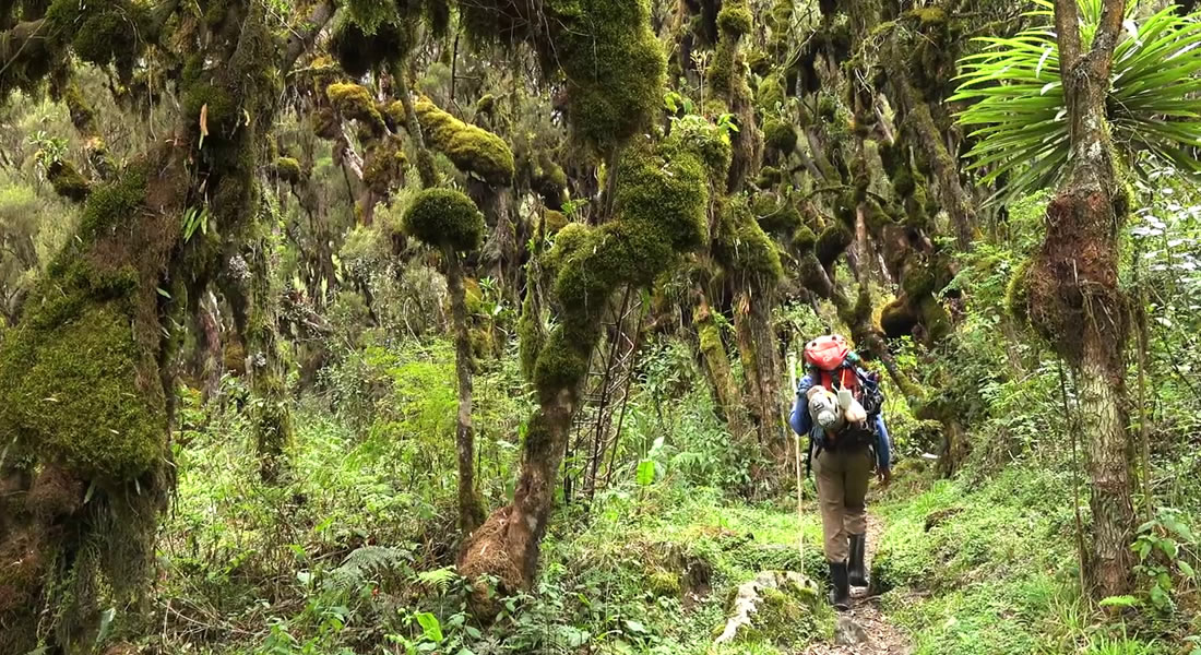
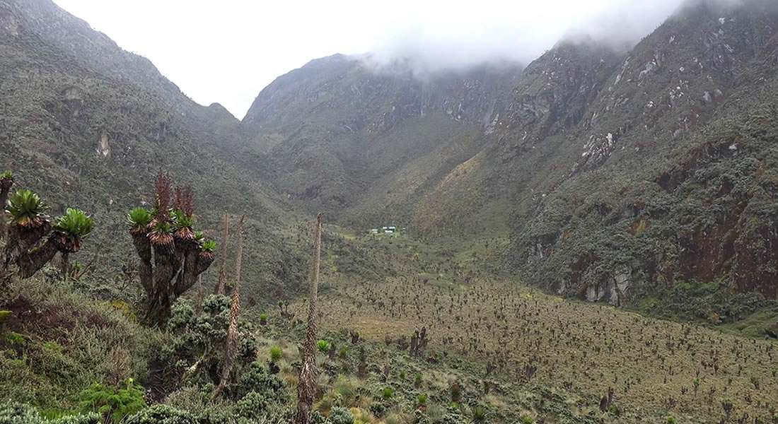
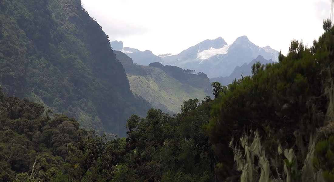
Rwenzori Mountains National Park is a beautiful landscape protected by the Rwenzori mountains, also known as the mountains of the moon. The national park has a remarkable number of animal species, some of which are only found in the area. However, it is ranked more for its flora than for its animal diversity because it passes through a variety of vegetative angelic zones, including the farms of the nearby communities, montane forest, bamboo under shed by mimulopsis, a heather zone characterized by the giant tree heathers, together with beautiful forms of the giant lobelia, the forest lies at an altitude of 5109m high above sea level its highest peak being Margarita. Rwenzori is arguably the best place for mountain hiking in Uganda.
Animals such as elephants, giant forest hogs, bushbucks, leopards, primates like the black and white colobus monkey, blue monkeys, and the hyrax are present in the national park, some of which are endemic to the Rwenzori Mountains. It should be noted that animal species are rare to see in the national park. The Rwenzori Mountains National Park is adventurous compared to other mountains. It is the only snow-capped mountain a few miles away from the It features more than 200 bird species, the majority of which are limited to the Albertine Rift Valley. Common examples include the malachite sunbird and Rwenzori turaco.
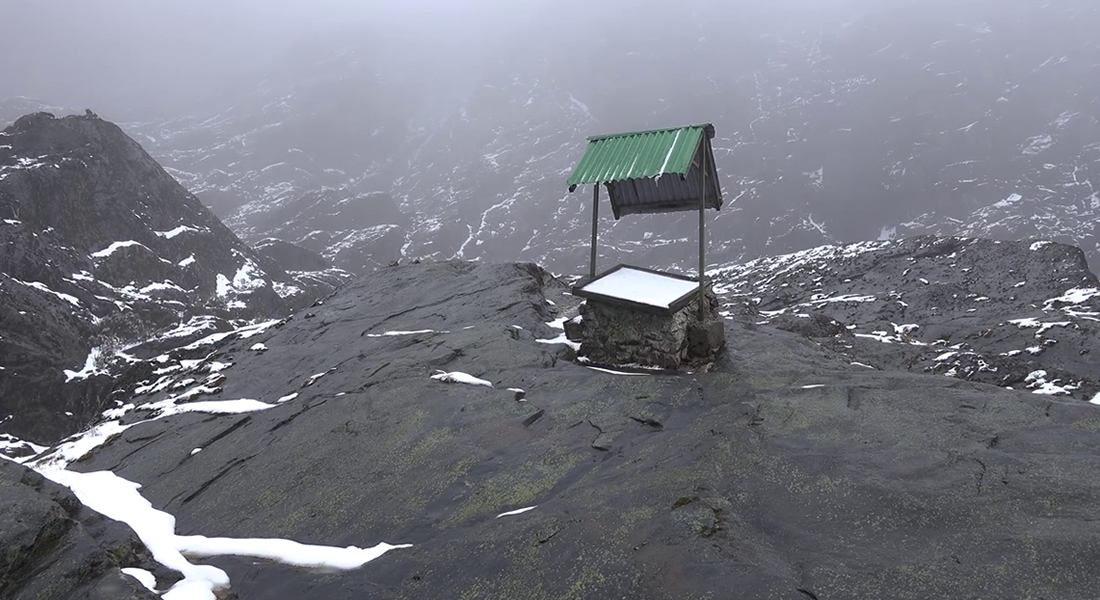
The Rwenzori region is cold; therefore, it is advised to carry raingear, spare clothes, water, hand gloves, and any other material you may need for the adventure. Mountain Hiking in Uganda on the Rwenzori can be done on a seven-day trail; the central circuit trail is typically organised through the Rwenzori mountaineering services, beginning the adventure at the Nyakalengija.
Despite the area not being well developed with facilities, the central circuit is provided with the basic huts, camping rooms, and the Rwenzori mountaineering guesthouse. Mount Rwenzori has several activities that can be participated in, including bird watching, hiking, mountain climbing, guided nature walks presented on an opportunity of the presence of the mountains of the moon, first discovered by a geographer Alexandrine in 150 AD who managed to name it on the world map. Fort Portal and Kasese settlements, which are close to Queen Elizabeth National Park, offer additional lodging.
The park can be visited all year round, but it is best to go during the dry months of December to February and June to mid-September when the trails are less slick and easier to climb. The park receives 2500mm of rainfall annually and is about 375 square kilometres in size via the fort portal. Charter flights can be arranged from Entebbe or Kajansi to the closest airport in Kasese.
The critically endangered mountain gorilla species and golden monkeys are found in Mgahinga Gorilla National Park, the smallest of Uganda’s gazette protected areas. The park is situated in the south-western region of the country and is surrounded by the slopes of the mountains Muhabura, Mgahinga, and Sabinyo, which provide a stunning backdrop. The huge Albertine rift valley is bordered to the south by these three volcanoes; the park’s tiny size of 33.7 square kilometres is complemented by national parks in Rwanda and the Democratic Republic of the Congo that are nearby. It is one of the coldest regions in the nation and is located between 2227 and 4127 metres above sea level.
The peaks in the national park are used for volcanic climbing. The three peaks of Mgahinga, Muhabura, and Sabyinyo provide a variety of climbs to suit different skill levels. The walks start at the Ntebeko tourist centre, an observation platform, and the three summits may be scaled. The three highest volcanic peaks are Muhabura (4127 m), Sabyinyo (3669 m), and Mgahinga (3474 m). Sabinyo’s rim earned the nickname “old man’s teeth” owing to the worn, jagged form of the rocks at the top hill. Muhabura, which means “the guide,” was given the name in the 19th century when the mountain used to shine, giving a natural light for travellers. Mountain Hiking in Uganda gives you a chance to spot these mountain peaks.
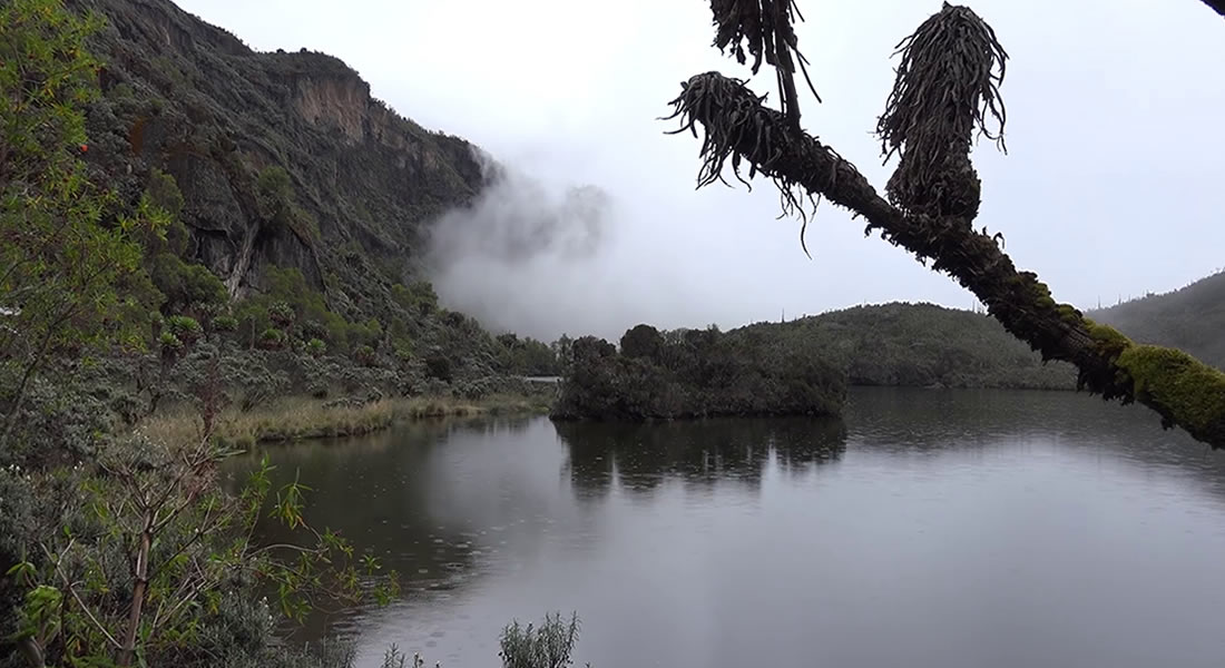
The mountain Sabyinyo has three peaks that are shared by three countries: Uganda, Rwanda, and the Democratic Republic of the Congo; this implies that one has a chance to step in the three countries. It is possible to hike the ragged mountain only if you have a guide. Mgahinga is the lowest of the peaks, and the locals commonly refer to it as a pile of stones. It is visible in Kisoro town and around the Mgahinga region. The tallest of the volcanoes, Mount Muhabura is capped with a tiny, lovely crater lake that flows through various vegetation types, providing magnificent views of Lake Edward and Mountain Rwenzori. On a good day, you could even have an opportunity to observe golden monkeys.
The Mgahinga Gorilla National Park, the nation’s smallest national park with a surface area of 33.7 square kilometres, contains Mount Sabyinyo, one of the great series of the Virunga Mountains. The park’s slopes are covered in bands of altitudinal vegetation that range from farmlands that the local population has covered to undisturbed montane forest followed by a bamboo zone, which is home to the renowned mountain gorillas.
There are three summits on Mount Sabyinyo. In order to reach the second peak, you must first ascend the first peak. The third peak is located on muddy steep slopes, and the mountain’s rim has weathered into stubby peaks, earning the name “old man’s teeth” as the locals refer to it because of its nature and how it appears from a distance. Depending on one’s level of physical ability, one may be able to trek all three of Sabyinyo’s peaks, which provide stunning views of the Virunga volcanoes.
The names of the three summits, Muhabura (4127m), Sabyinyo (3470m), and Mgahinga (3474m), which are all climbable, derive from the translation of Muhabura, which means the guide. In the 19th century, the mountain’s crater still burned, providing travellers with a natural lighthouse. The region is home to mountain gorillas that roam freely within the nations; on the Ugandan side, the Nyakagezi gorilla family can be seen at any time of the year. These peaks mark the southern limit of the Albertine Rift Valley and are shared by Rwanda, Uganda, and the Democratic Republic of the Congo. The Ugandan portion of the Virunga parks is smaller in comparison to the other parks, with the others standing out with a bigger number of mountain gorillas. Hence it is advised to make reservations in advance for gorilla permits costing 700 USD.
Gorilla tracking is the most popular activity in the park, but it can also be combined with mountain climbing. Other activities include bird watching, mountain biking, and guided nature walks. The park has two rainy seasons, with the wettest month having 250mm of rain and the driest month having 10mm. The best times to visit are between December and February and June and mid-September.
The equator divides Uganda in half, giving it an equatorial climate. Hiking in protected areas is amazing; there are short hikes like those in Kidepo Valley National Park around Mount Morungule and hikes to the top of the falls at Murchison Falls. Mountain hiking requires physical fitness to reach the summit; it should be noted that movement is determined by the speed of the person before you.
Wear warm, long-sleeved clothing, boots, socks, and warm jackets because some of these regions, like the Rwenzori, are very cold and require a lot of warmth. Trips that last longer than a day will require you to carry a sleeping bag because there are no hotels en route to the highest peaks of the mountain. Hikes are led by knowledgeable, experienced game rangers who will ensure you enjoy the forest. Contact us to know more about mountain hiking in Uganda.